


jhgr

Clo0413
User
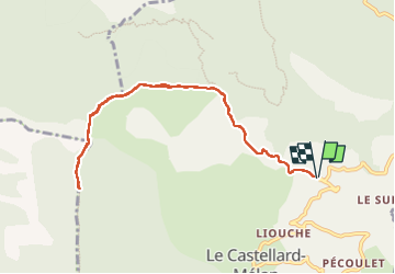

Length
9.8 km

Max alt
1353 m

Uphill gradient
345 m
Km-Effort
14.4 km

Min alt
1200 m

Downhill gradient
348 m
Boucle
Yes
Creation date :
2025-01-03 08:54:20.158
Updated on :
2025-01-03 13:16:50.993
2h49
Difficulty : Difficult

FREE GPS app for hiking
 SityTrail
IGN / Geographical institutes
SityTrail Plus
The world is yours!
About
Trail Walking of 9.8 km to be discovered at Provence-Alpes-Côte d'Azur, Alpes-de-Haute-Provence, Le Castellard-Mélan. This trail is proposed by Clo0413.

Positioning
Country:
France
Region :
Provence-Alpes-Côte d'Azur
Department/Province :
Alpes-de-Haute-Provence
Municipality :
Le Castellard-Mélan
Location:
Unknown
Start:(Dec)
Start:(UTM)
271047 ; 4897823 (32T) N.
Comments